SCOPE-ERA5
Station-calibrated reanalysis — a continuous, gap-free historical baseline that matches observed local conditions.
Explore the viewer →
Data & Tools
 — Station-Calibrated Outputs for Planning & Engineering — is a
family of bias-corrected weather and climate datasets, calibrated to real weather-station
observations, so your analysis starts from a baseline that matches the ground, not a
grid-cell average.
— Station-Calibrated Outputs for Planning & Engineering — is a
family of bias-corrected weather and climate datasets, calibrated to real weather-station
observations, so your analysis starts from a baseline that matches the ground, not a
grid-cell average.
For engineering firms, utilities, energy modelers, insurers, and infrastructure owners.

Reanalysis products like ERA5 are global, hourly, and gap-free — but each value represents a grid cell roughly 31 km on a side (about 1,000 km²). Inside that cell there can be mountains, coastlines, forests, and cities. A weather station measures one point.
When gridded data is used as if it were a local observation, the difference shows up in the mean, the variability, and the extremes — and it propagates into design values, energy models, and climate-risk estimates. If the historical baseline is biased, everything built on top of it can be too.
Explore these discrepancies worldwide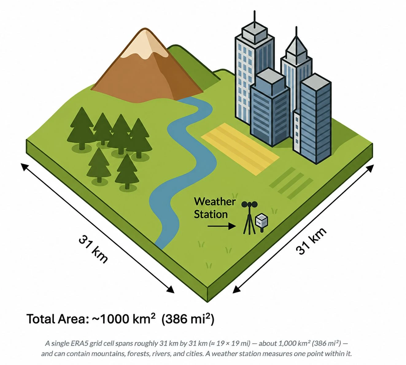
Why SCOPE
Weather stations are locally accurate but sparse and gappy. Gridded products are global and continuous but smooth away the local signal. SCOPE is built to be both.
| Dataset | Global coverage | Gap-free daily series | Matches station observations |
|---|---|---|---|
| Weather stations | ✓ | ||
| ERA5 (raw) | ✓ | ✓ | |
| GMFD / NEX-GDDP | ✓ | ✓ | |
| SCOPE-ERA5 | ✓ | ✓ | ✓ |
The family
The same station-calibration method, applied from the historical record through future climate projections — so your baseline and your projections speak the same language.
Station-calibrated reanalysis — a continuous, gap-free historical baseline that matches observed local conditions.
Explore the viewer →Station-calibrated regional climate projections, built on CORDEX downscaling for higher-resolution future scenarios.
Explore the viewer →Station-calibrated global climate projections from CMIP6, for consistent, worldwide forward-looking analysis.
Explore the viewer →How it works
Corrected against high-quality in-situ weather-station observations, so values reflect point-scale conditions — not a grid-cell average.
Temperature, humidity, wind, and pressure are adjusted together, so derived metrics like heat index and wet-bulb temperature stay physically consistent.
Continuous daily time series that preserve the temporal sequencing of the underlying data — fragmented station histories become complete records.
The same method everywhere, so locations around the world are estimated on one consistent, comparable basis.
What you get
Does it work?
Take Mumbai's main airport. In a typical year the station records about 177 days above 32.2 °C (90 °F) — but raw ERA5 records zero, because its grid-cell average smooths the local heat away. ERA5 misses the other way too, over-counting warm nights. SCOPE-ERA5 brings both back in line.
SCOPE-ERA5 is benchmarked against a global network of in-situ weather stations and documented in the peer-reviewed literature — not a black box.
Share of evaluated weather stations where SCOPE-ERA5 reduced error (RMSE) versus raw ERA5 reanalysis.
Source: Rasmussen (2026), “Multivariate bias correction of ERA5 using in-situ observations for planning and engineering,” Environmental Research: Climate.
Where it's used
Design-day and degree-day conditions calibrated to the site, consistent with weather-station-based standards.
Reliable temperature, humidity, and wind inputs for load and peak-demand simulations.
An observation-aligned baseline so projected change isn't masked by a biased starting point.
Consistent, comparable indicators across global portfolios.
See how station calibration changes the baseline, then bring the data into your own workflows.
