Specialist climate and hazard expertise for engineering and consulting teams
Degree Day provides senior climate-science support when projects require analysis beyond standard datasets and off-the-shelf tools.

Climate information is only useful when it helps answer a real question. Degree Day provides the expertise, datasets, and decision-support tools needed to apply climate information appropriately.

Custom riverine, coastal, and pluvial flood modeling for sites, corridors, watersheds, and coastlines. Defensible results without a months-long engineering study.
Embedded climate expertise for engineering firms and consultancies that need senior technical support without adding full‑time headcount.

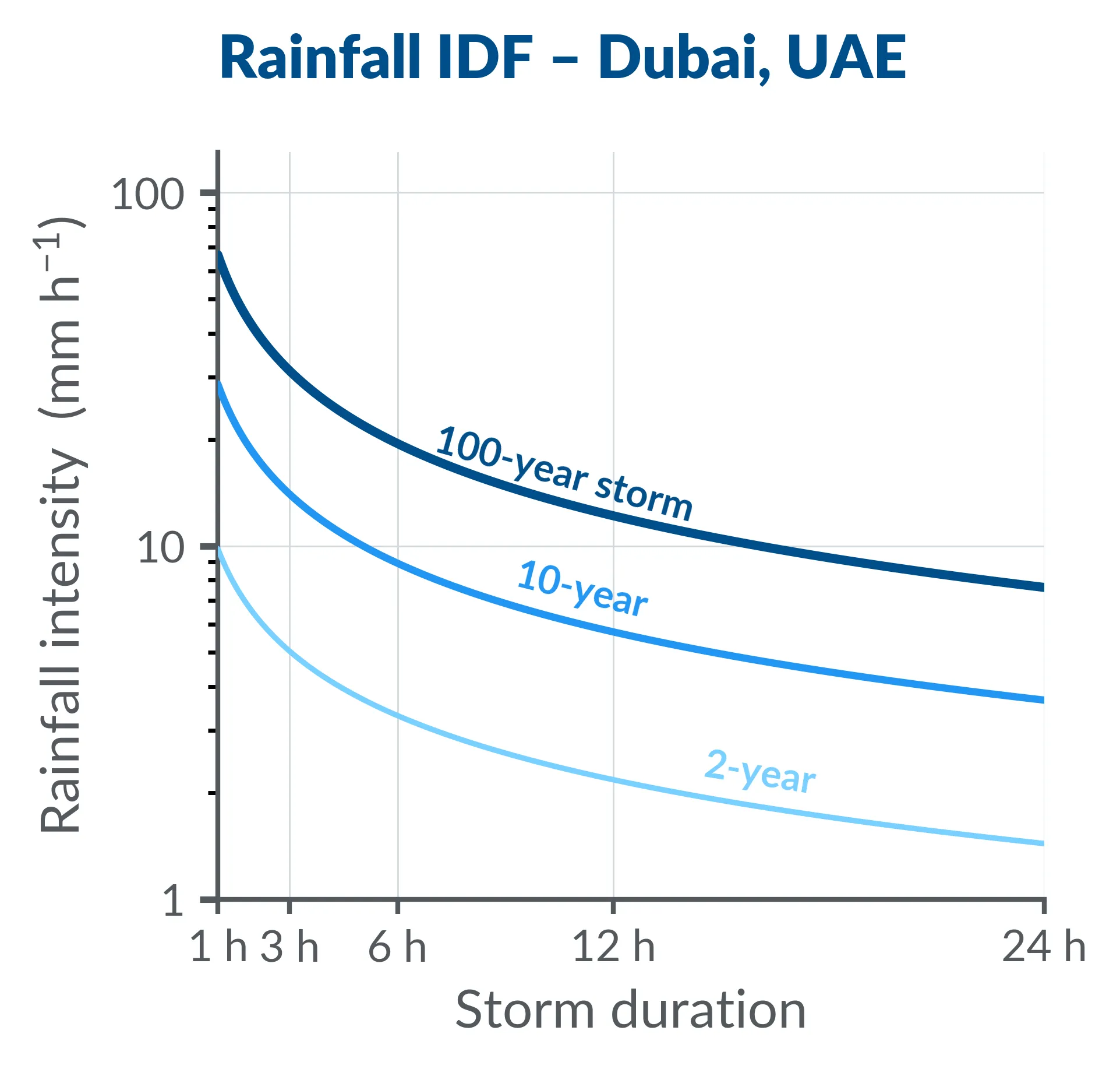
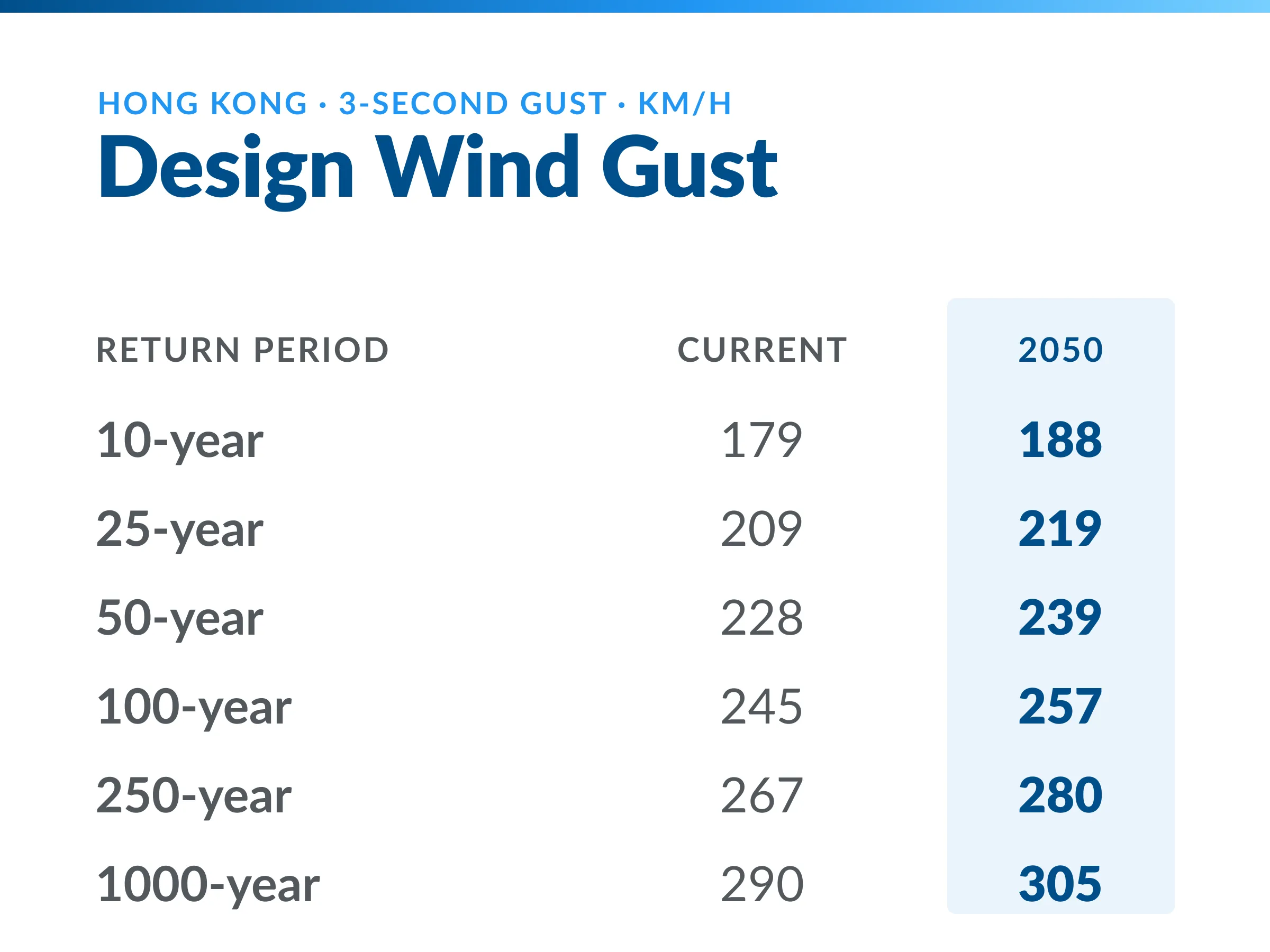
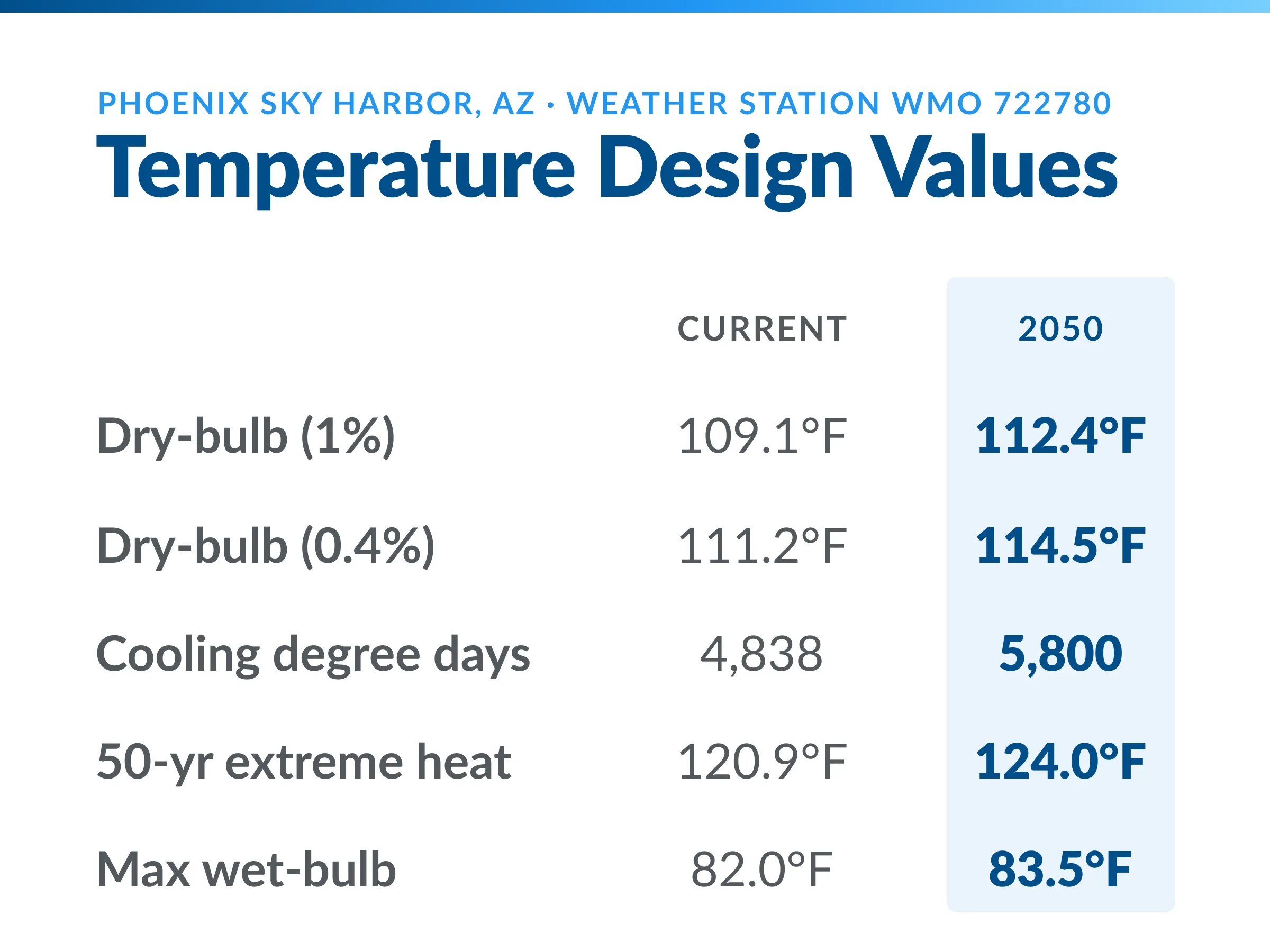
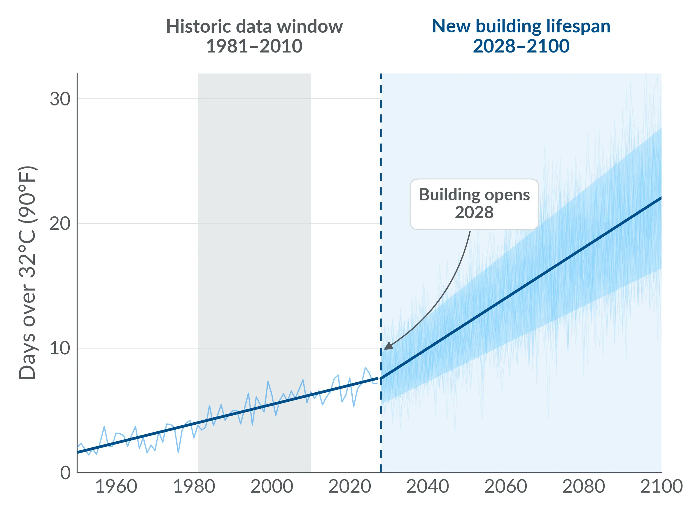
Site-specific rainfall, heat, and wind values for infrastructure that must perform under future climate conditions.
Design for the Climate Ahead
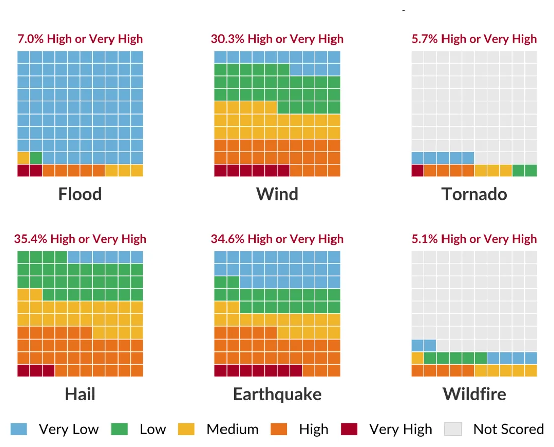
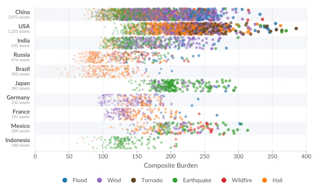
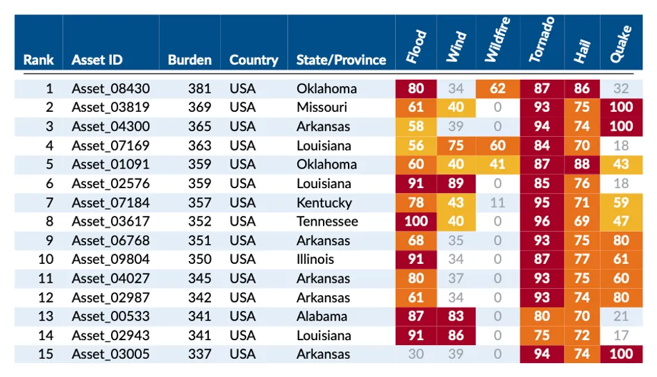
Transparent climate and natural-hazard screening to identify exposed assets, compare hazard drivers, and decide where deeper review is needed.
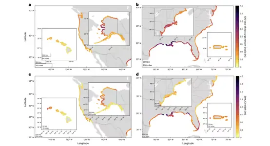
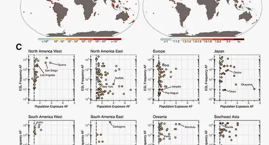
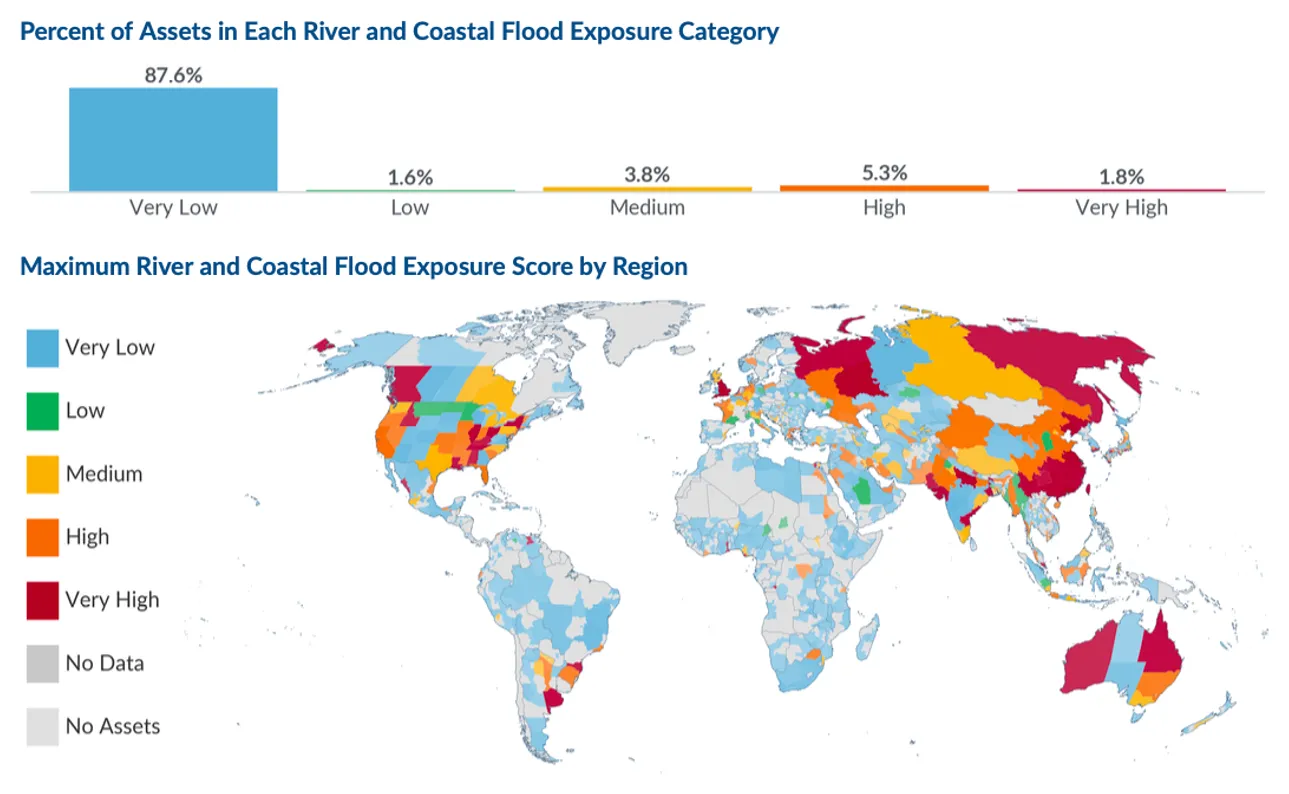
Where River and Coastal Flood Exposure Is Concentrated
Need independent expert review, custom research, or help interpreting conflicting climate data?
Explore Independent Review & Advisory21 climate and natural-hazard layers, mapped worldwide — from wildfire and extreme heat to coastal flooding.


Climate intelligence for organizations designing, operating, and investing in long-lived infrastructure

Climate data and technical expertise for infrastructure design, resilience planning, and technical deliverables that require defensible methodologies

Independent advisory for grid resilience, water system adaptation, and capital investment decisions for critical infrastructure operations.

Technical support for adaptation planning, resilience bond justification, and climate risk assessment for public infrastructure systems. Decision-making, not academic completeness

Expert climate analysis for site selection, design criteria development, and long-term risk assessment in due diligence and development planning.

Decision-grade climate intelligence for asset assessment, portfolio risk screening, and capital allocation decisions with multi-decade horizons.

Climate science capacity for client projects. White-label technical support, sub-consulting, and embedded expertise for your team.
Coarse global models blur extremes that drive local risk.
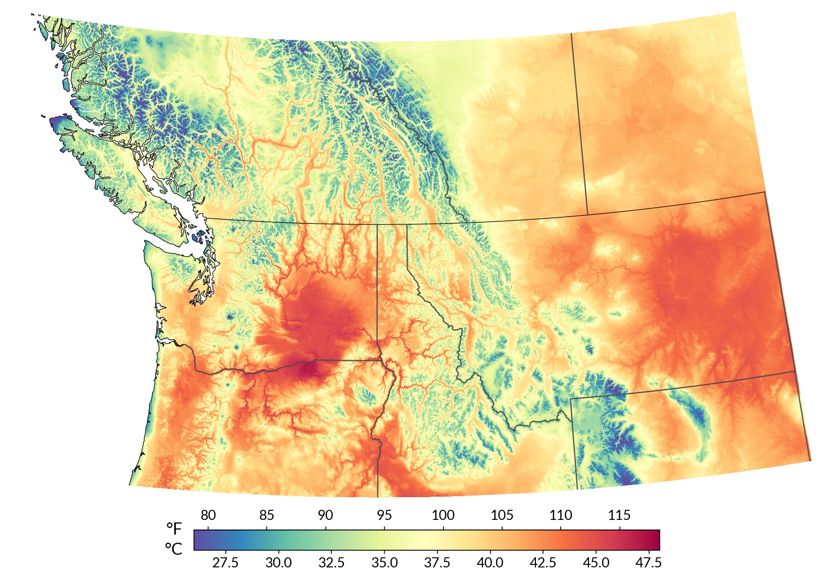
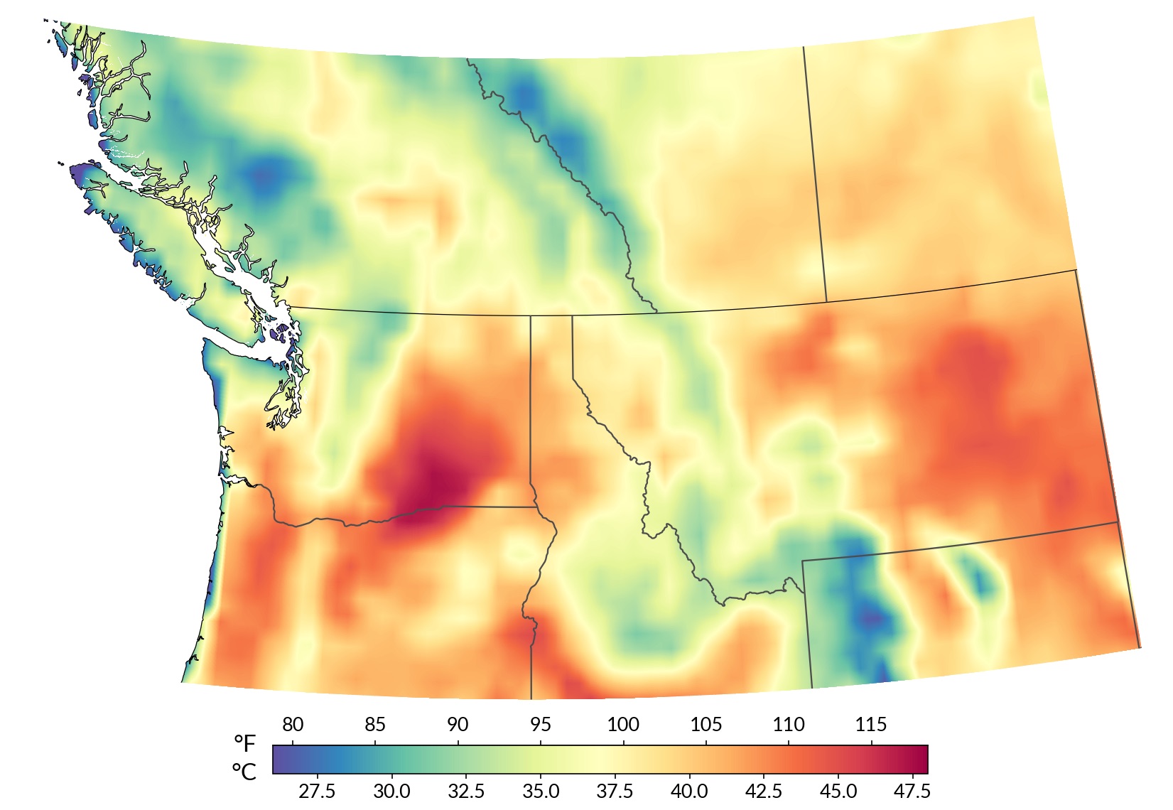
 · 1 km
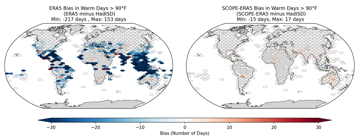
 Benchmarked against a global network of in-situ weather stations — not just other models.
Share of weather stations with lower RMSE than raw ERA5.
Source: Rasmussen (2026), “Multivariate bias correction of ERA5 using in-situ observations for planning and engineering,” Environmental Research: Climate.
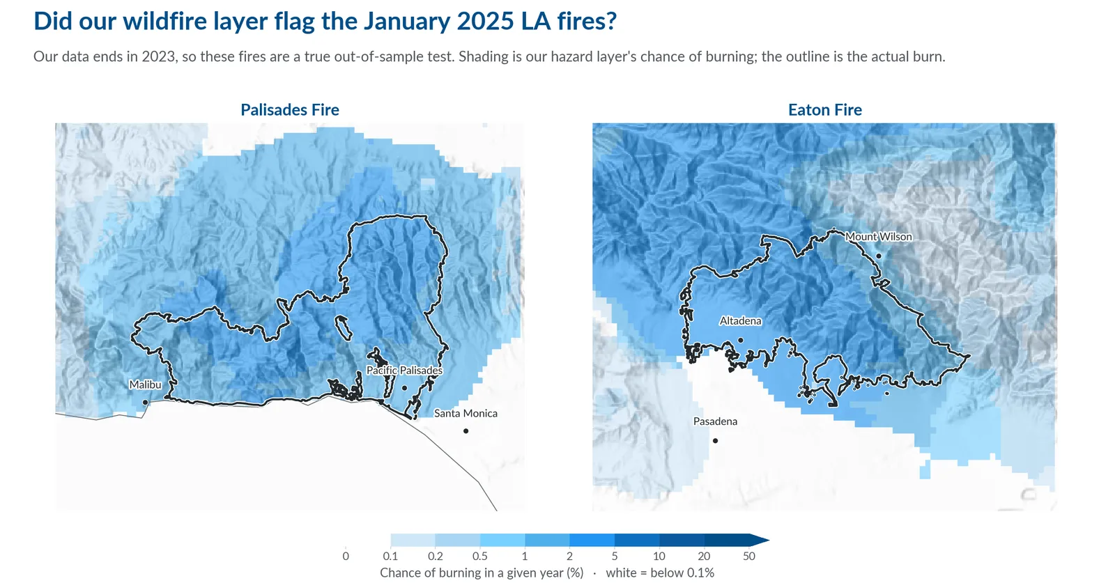
A model scored on the data it learned from will always look good. The real question is how it performs where it has never looked. This is how we tested our wildfire layer.

One coastal property. Thirteen vendors. One of them found no flood risk at all. If the models cannot agree, what should an organization actually do?

A bias-corrected, multivariate, station-calibrated reanalysis dataset built for engineering and planning workflows that demand reliable local weather data.